Blind Hikerz is an adventurous trek organised by Bangalore Ascenders (BASC), where neither a proper path nor any type of route exists. The trekkers need to follow the GPS systems directed way and the animal trails. Mental readiness to face any situation is prevalent for these treks. Situations may include anything like sudden stiff ascend/descend, animal sight..river crossing and passing through deep shrubs and jungle which are not ventured normally. Many a time one needs to walk hanging from the tree trunk to another to maintain proper balance on those highly inclined slopes. And BASC calls it Jumanji also.
One of such treks I participated during the last weekend of Jan 2012 was organized by Sudheer from BASC. The trek was for 2 days i.e. 28th & 29th Jan 2012. To make this trek more exciting they decided to disclose the place name on the spot just before the trek starts. With lots of expectations and enthuse I was waiting to know the name of the place till 27th evening. And really got very much excited when came to know that it would be near to Dharmasthala.
27th Jan night: We meet at Shanthala slik shop near mejestic. The team was led by Sudheer the Captain and Jinu the Vice Captain. Participants include Vani, Girish, Shobhana, Gayathri, Abhilash, Sarashchandra, Sreedhar and myeslf. We left Bangalore at around 11 PM. The driver was very young and energetic. He drove very fast but carefully. We had almost a satellite TT journey.
 |
| D team |
 |
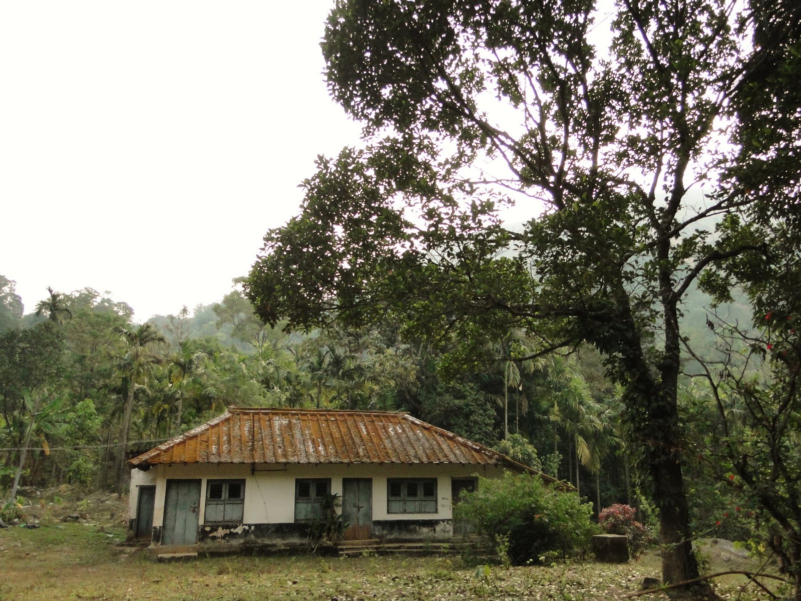
| The 300 years old Shiva temple |
 |
| Ettina Bhuja was clearly visible... |
 |
| We came from |
 |
| Snake scale |
We started crossing stiff ascends, stiff descends, mountains, valleys, streams with rocks. Streams were all across. We never had a water scarcity anywhere during this trek. Following photographs will describe the trek.
 |
| Mountain ranges of Charmadi Ghats |
 |
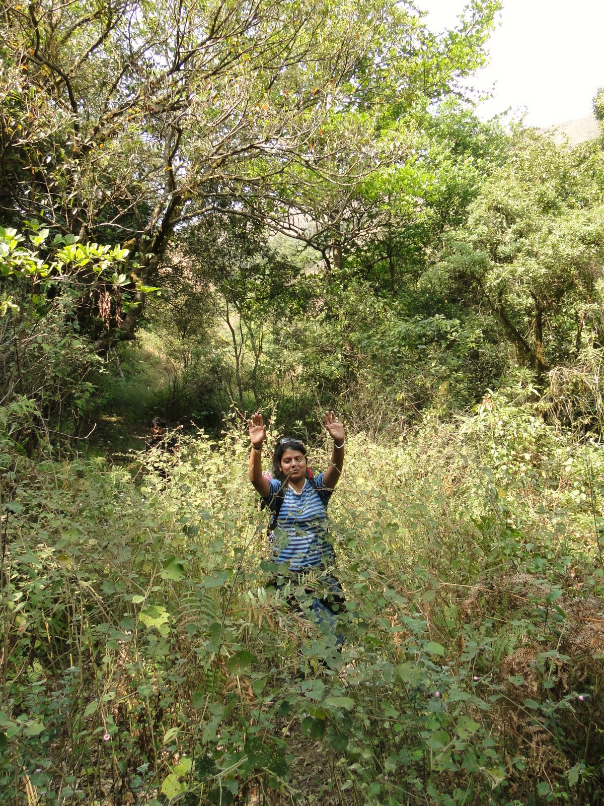
| Deep into the wilderness..stiff descends |
Walking through these shrubs is not a easy job. One needs to be careful always because there are many a thorny plants. These kept blocking our movements. But it really worth taking such risk.
 |
| Path defined with GPS into the no path zone |
 |
| Dense forest |
 |
| Back up on the hill |
 |
| Ettina bhuja kept a close watch on us |
 |
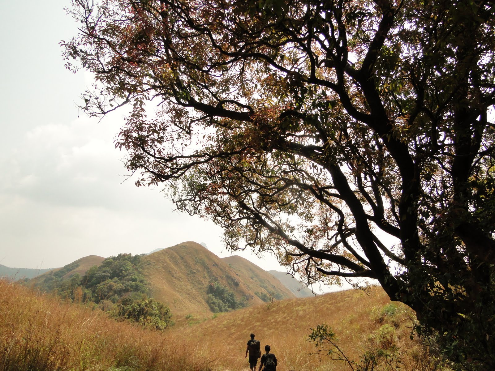
| The Greenlands |
 |
| Surrounded by mountains |
 | ||
Walking on the hills
|

 |
| Descending from the hills to the valley hanging from the trees |
 |
| Waiting for the decision weather to keep going down or to move back up |
We were almost hanging from the tree trunk as it was very stiff descend. We were waiting to get a green signal from Sudheer to move ahead. Many a times we faced this as we were following GPS directions and it does not show proper path .
 |
| Ettina Bhuja kept watching us from the distant |
 |
| Keep descending... |

 |
| Resting for a while after that stiff descend.....many of us slipped descended |
 |
| A short photography session while resting |
 |
| Abundance of water sources |
And after this place we kept climbing the more stiffer inclinations which made it impossible to take photographs. After the next ascend and descending to another valley we reached to another stream where we had our lunch. We were almost deadlock here. We came down to this stream from a stiff inclination, cant move through either sides of the stream as these rocks were full slippery and impossible to walk upon. We decided to start ascending the other side of the valley and this was the most difficult ascend of the entire trek. Started will rocks, loose stones and soil and then dry sharp grasses. Till some extent we could take the support from trees. Continued climbing hanging from one tree to another. Finally after half an hour or so we reached the hilltop. We could see the one side of the mountain grass is being burnt. We took rest for a while and based on the GPS direction proceeded towards the another valley to walk on the jeep track, which took us to a one house village. That part of the journey was a great relief. The name of the village - Kumbarahalli.
 |
| The mountain ridges |

 |
| Decided to camp at Kumbarahalli village |
After reaching these village we all agreed to halt there for the night. Because the exit point, Sreeshila was around 5-6 kms from here and it was about to dark fall by the time we reached there.
Some of us decided to explore the nearby village which was 4 kms. And few decided to not to venture into. I sat at the waterfall and enjoyed the time. And rest went ahead just to land up walking for maximum 1-1/2 km.
 |
| The brilliant waterfall near to the village where I spent some time in solitary |
 |
| Path leading to another village |


 |
| The Master Chef |
29th Jan: The second day started with bowels & plates of tea and other food items. We decided to not to prepare Maggie etc to save upon time. Our plan for the 2nd day was to explore the jungle to exit at Srishila. Take a jeep/bus to reach Dharmathala. At Dharmathala have darshan and leave for Bangalore. Our TT was waiting there. But it did not go as per the our plan...Below photographs will explain what happened with us for the entire day.
After this we kept on walking in the wrong direction into the dense and stiff forests of Charmadi ghats. Now I dont remember how many times we walked back on the same trail. Ascending and descending continued.....


Few more wrong steps...in search of right path but in vain


Somehow by 1 PM we were managed to back to the place (not the village, path to the village) where we started the trek on Sunday. After reaching to a point we decided to explore further for another 1 hour to reach our destination of the day, Srishila ; if failed we would come back and proceed towards the villages following the same path we came. GPS showed the direction and all of us followed just to walk inside the dense forest full with thorny shrubs and plants. After walking for more than half an hour we reached a place where we could not proceed further. On this route we could see animal kills. We decided to return and finally by 2:30 we were back to the village where we stayed previous night. We had quick Maggie, took bath and requested the villager to take us out of the jungle. The villager told us its just 4 Kms, and would take 45 minutes to max one hour. So we were relaxed and spend good time at the nearby water falls to get refreshed. By 3:30 we started another trek to reach to the village. Soon we realized that we should have started little early. We continued walking through little stiff jeep track. It took almost around two and half hours to reach that village. It was almost dark by the time we reached that village, named Kondanahalli. There from we took a jeep to reach Mudigere..
We reached Mudigere around 7:30PM. We were to take bus from here to reach Dharmasthala, have darshan and leave for Bangalore. Because our TT was waiting there. But this plan also did not work out. As soon as we got down from the jeep, we came to know that the bus scheduled to leave for Dharmathhala at that time got punctured. We had to abandon our 2nd plan too and called the TT driver to come to Mudigere. At Mudigere we finished our dinner and waited for the TT till 11 PM.
....After a long wait the TT came and we left for Bangalore.
The big lesson learnt: A GPS device can show you a right direction towards your destination. But weather a walkable path or at least a passage exist or not is your duty to find out.
Overall experience: It was superb.
More photographs: https://picasaweb.google.com/117144221978749494916/BlindHikerz2UrfJumanjiSeriesCharmadiGhats
 |
| Plates of tea |
 |
| Bowels of tea.. |
 |
| The villager who gave us shelter in his house and the courtyard ..he was the person who finally helped us to be out of the jungle |
 |
| Some of us spent the night there |
 |
| ...and other slept here.. |
|
| All ready for the 2nd day trek... |
 |
| Warm welcome by the Grey Heron |
 |
| The horse trail... |


 |
| This was around 11 AM...we were crossing this place to get lost in the jungle for big time...and by the mid day we were again back to this place |


 |
| Way to the wrong direction...more dense forest |
 |
| The monolithic rock in Shivaling shaped...we had to come back this place... |
 |
| We halted for a while to quince our thirst....drank lots of water.. |
 |
| We have been waiting for Jinu and Sudheer to return...they went in search of right path...but that path led us to even more stiff and dense forest... |
 |
| .....and again after walking for more than 20 minutes of so were dead stuck...no proper passage to walk further. We waited here more than half an hour discussing what would we do if were to die there in the wilderness of Charmidi Ghats.. |
 |
| and finally started following the same path we came..one the way returning.. |
 |
| On the way returning.. |
 |
| Again the uphill area... |


 |
| Exploring.. |


 |
| Color of the Forest |
 |
| While descending.. |

 |
| Way back |
 |
| Source of Kapila Theertha river |


Somehow by 1 PM we were managed to back to the place (not the village, path to the village) where we started the trek on Sunday. After reaching to a point we decided to explore further for another 1 hour to reach our destination of the day, Srishila ; if failed we would come back and proceed towards the villages following the same path we came. GPS showed the direction and all of us followed just to walk inside the dense forest full with thorny shrubs and plants. After walking for more than half an hour we reached a place where we could not proceed further. On this route we could see animal kills. We decided to return and finally by 2:30 we were back to the village where we stayed previous night. We had quick Maggie, took bath and requested the villager to take us out of the jungle. The villager told us its just 4 Kms, and would take 45 minutes to max one hour. So we were relaxed and spend good time at the nearby water falls to get refreshed. By 3:30 we started another trek to reach to the village. Soon we realized that we should have started little early. We continued walking through little stiff jeep track. It took almost around two and half hours to reach that village. It was almost dark by the time we reached that village, named Kondanahalli. There from we took a jeep to reach Mudigere..
 |
| It was full dark then... |
 |
| We were waiting like refugees. Every passersby were looking at us very curiously... |
The big lesson learnt: A GPS device can show you a right direction towards your destination. But weather a walkable path or at least a passage exist or not is your duty to find out.
Overall experience: It was superb.
More photographs: https://picasaweb.google.com/117144221978749494916/BlindHikerz2UrfJumanjiSeriesCharmadiGhats